Current projects
Past projects
Spatial analysis of change in stand structure using LiDAR data and historical observations at Blacks Mountain Experimental Forest
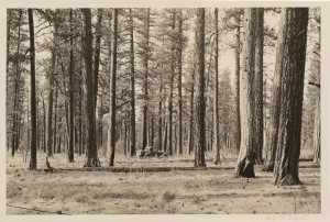
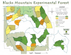
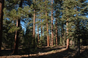
Fire is a key component of stand dynamics in interior ponderosa pine stands throughout western North America. In this project, historic data collected at the Blacks Mountain Experimental Forest in California, USA, will be used to describe pre-harvest reference conditions across an interior pine forested landscape (4,000 ha). This will provide historic conditions of stands that were resilient to fire such that large stand replacing fire events were infrequent. High resolution LiDAR data from 2009 paired with current ground data provide the most recent stand conditions at a finer spatial resolution than the historic data. We will describe the pre-harvest historic reference conditions and variability of forest stands and will perform spatial analyses of forest conditions and change over 76 years at the Blacks Mountain Experimental Forest.
This research is funded by the USDA Forest Service, PSW Research Station, and conducted in collaboration with Dr. Martin Ritchie.
Fire effects and ecosystem recovery after forest wildfire
This research is funded by the USDA Forest Service, PNW Research Station, and conducted in collaboration with Dr. Vicente Monleon.
Eskelson and Monleon (2018) provides unparalleled insights into surface fuel dynamics after wildfire. The wildfire and forest stand conditions represented in the study data are representative of what occurs on the landscape. Thus, the estimated trends from this study can be generalized to all wildfires in the region that burned with low, moderate, or high severity in hardwood or dry conifer stands in California.
Status and trends of whitebark pine distribution and health in California, Oregon and Washington
The Forest Service provides estimates of forest and range ecosystem conditions for Pacific Coast states. There is a general consensus that whitebark pine is declining throughout its range. The threats to the species are such that, on July 19, 2011, the US Fish and Wildlife Service determined that listing whitebark pine as threatened or endangered under the Endangered Species Act of 1973 was warranted. The annual Forest Inventory and Analysis Program (FIA) inventory covers the entire range of the species in the Pacific coast. We aim at providing statistically-based estimates of population dynamics of whitebark pine for the species’ western range.
This research is funded by the USDA Forest Service, PNW Research Station, and conducted in collaboration with Dr. Vicente Monleon.
Climate envelope modeling
USDA Forest Service
Quantification of fire effects and post-fire dynamics (NSERC DG)
Boulder Creek Fire Case Study
In summer 2015, several large and severe forest fires burned in the coastal fire region of British Columbia (BC), burning thousands of hectares of forest. This case study focuses on the Boulder Creek fire, which burned approximately 7,000 hectares of coastal transition forest north of Pemberton, BC. The focus of the study is on the impacts that Boulder Creek fire had on aboveground carbon pools: duff, litter, woody debris, and standing trees. The study aims to provide baseline data on forest carbon after a coastal forest fire across fire severity classes, as well as to establish permanent sample plots within the Boulder Creek fire boundary.
This research is funded by NSERC, and conducted in collaboration with Ecofish Ltd. and Dr. Lori Daniels (UBC).
Thesis: Impacts of wildfire on forest surface fuel carbon in Pacific Northwest forests (Kate Peterson, M.Sc)
Research featured by “Inside the Forest Service”: Fire study will help project future carbon dynamics
Photo: Kate Peterson
Conifer performance, stand productivity, and understory cover in varying densities of mixed conifer-broadleaf stands in southwestern British Columbia
This research was funded by an NSERC USRA awarded to Yudel Huberman.
Tree Height Increment Models for National Forest Inventory Data
This research was funded by the USDA Forest Service, PNW Research Station, and conducted in collaboration with Dr. Vicente Monleon.
Invasive Plant Species in Urban Greenspaces
- Invasive plants occurrences in urban greenspaces: socioeconomic and greenspace types predictors
- The public’s risk perception of invasive plant species in Metro Vancouver
Invasive plant invasions reduce biodiversity values, can cause human health problems, and are costly to control. This project utilized available socio-economic, greenspace type and invasive plants inventory data in the Metro Vancouver region to assess the relationships between socio-economic factors, greenspace type and species occurrences. The findings of this study provide managers with insight on which areas are at high risk of plant invasions based on their socio-economic factors and greenspace types and should be targeted for spread prevention management.
This research was funded by the University of British Columbia Hampton Research Endowment Fund, UBC Bridge Funding, and NSERC ENGAGE in collaboration with Diamond Head Consulting Ltd.
Linking Inventory with Simultaneous Tree, Stand, and Forest Forecasting
The mountain pine beetle outbreak across the interior of British Columbia (BC) has resulted in substantial lodgepole pine mortality over the last 15 years, which, in turn, has led to changes in forest management and harvesting plans for associated forest types including interior Douglas-fir (IDF) forests. Forest growth and yield models provide a useful tool to decision-makers for adjusting these plans through evaluating forest responses to changing management regimes. However, the primary growth and yield models available for IDF forests, PrognosisBC, is cumbersome to use in the forest-level models used to support forest management planning when harvest delays occur.
Stand table projection models can be a feasible alternative in these circumstances. This modelling approach is a compromise between whole-stand and individual-tree models, capitalizing on advantages of both approaches. Incorporating theoretical distributions, such as the Weibull distribution, the stand table projection models can provide more useful details (e.g., future diameter distribution, volume prediction by size class) than whole-stand models. Moreover, it requires less input data and computing procedures for simulations, and thus is implemented more easily and cost-effectively than individual-tree models while often producing more reliable outcomes. The simplicity of the stand table projection model means that it can be easily integrated into other modelling frameworks, including forest estate models.
The objective of this research is to construct a stand table projection system for IDF forest types in BC that can be linked with high-resolution forest inventory based on LiDAR, multispectral imagery, and ground plot sampling and forest estate models.
Part of this research was funded by a Mitacs Accelerate project with West Fraser Timber Co. Ltd. and conducted in collaboration with Dr. Ian Moss (Tesera Systems Inc.) and Dr. Peter Marshall (UBC, Department of Forest Resources Management).
Climate, vegetation and wildfire patterns in western North America
This research was funded by the Healthy Landscapes Program at fRI Research and conducted in collaboration with Dr. David Andison.
Assessment of spatial and temporal patterns of headwater stream temperature
This research was funded by the USDA Forest Service, PNW Research Station, and conducted in collaboration with Dr. Paul Anderson


